
Newark ZIP Code Coverage
Newark has one primary city postal code and several related postal labels that need address-level verification. The City’s planning material identifies 43055 as Newark’s primary ZIP and identifies 43056 as Heath’s main ZIP. An archived USPS grouping ties 43055, 43056, 43058, and 43093 to Newark OH 43055, but that grouping does not establish a current city boundary or confirm delivery status for a particular address.
| ZIP | Areas Covered | Post Office | Notes |
|---|---|---|---|
| 43055 | Primary Newark; City Hall and core city addresses | Not separately verified | The City’s Newark-Heath plan calls this Newark’s primary ZIP. |
| 43058 | Newark post-office-box mail | Newark P.O. box mail | Not verified as a street-delivery neighborhood. |
| 43093 | Included in an archived USPS Newark grouping | Not separately verified | Current classification and recipient type were not located. |
| 43056 | Included in an archived Newark grouping; City plan identifies Heath as its main area | Not separately verified | Check the physical address instead of relying on the postal label. |
The Post Office column intentionally does not infer facility names that were not verified in the research. Each row describes a documented postal relationship, not a ZIP-wide list of people or properties.
Use USPS Before Newark Search
The official USPS ZIP Code Lookup is the first check for one physical Newark address. Its By Address route accepts an optional company name, requires a street address, and uses a city and state or ZIP. By City and State requires both fields, while Cities by ZIP starts with the five-digit ZIP. USPS expressly warns that a ZIP result does not confirm that a person or company is at the address.
Postal limit. Use USPS to normalize a delivery address, then use the county parcel records for property context. A postal result is not proof of a person’s location.
The USPS ZIP Code Lookup is the source captured below.
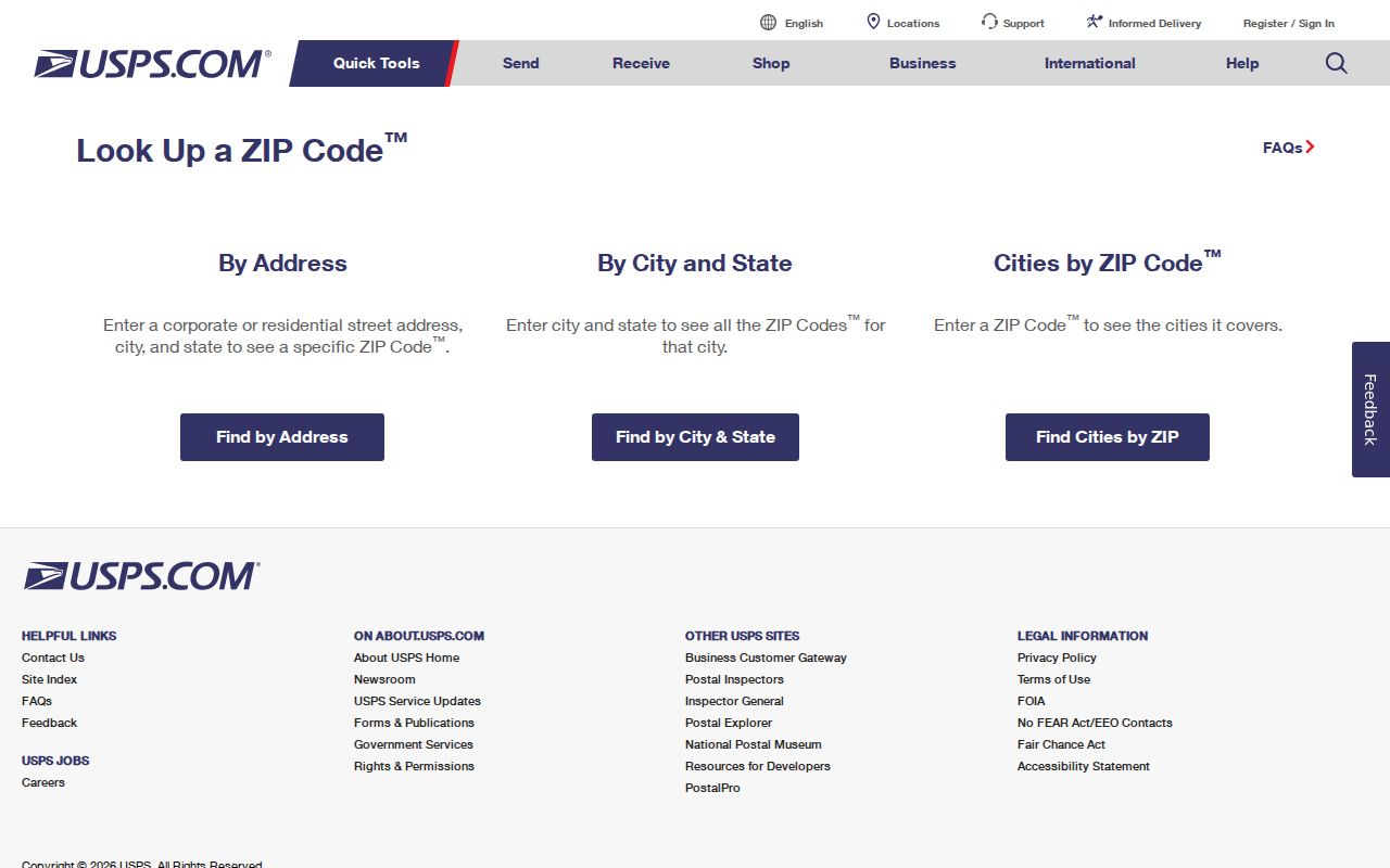
The three USPS routes make it possible to test a physical address, a named city and state, or an existing ZIP without confusing those tasks.
Search a Newark ZIP Address
Once USPS supplies a normalized physical address, the next Newark record is the parcel record, not a broad postal roll. The Licking County Tax Parcel Viewer is an address, owner, and PIN tool. It can connect a selected address to the Auditor PIN, Engineer PIN, Official Record, lot or subdivision, acreage, and legal-description context.
- Use USPS to check the complete physical address and retain the returned city and ZIP as postal information.
- Enter the beginning of that address in the Tax Parcel Viewer, using abbreviated directions and road types, then select the matching parcel.
- Preserve the parcel’s site address, city, ZIP when present, Auditor and Engineer PINs, and legal description. Keep any owner mailing field separate from the physical site field.
- If the postal and parcel labels conflict, compare the lot, subdivision, jurisdiction, and legal description before treating two similarly named places as the same property.
- Use the Official Record and the Licking County Recorder only when an instrument is needed to clarify the property trail.
After an address is normalized, the Newark Street Directory has the fuller by-address parcel and deed workflow. ZIP information narrows the first check; it does not replace the street and parcel identity.
Newark ZIP Source Limits
No local public portal with a verified ZIP-wide property or owner search was found. The Viewer’s records can contain ZIP-related parcel fields, but its documented search inputs remain address, owner, and PIN. The City LandView service exposes SitePostalZip and owner-mailing ZIP fields in its schema, yet that machine-readable field inventory is not a promise of a public ZIP browse screen.
| Source or search | Verified input or field | Useful ZIP role | Important limit |
|---|---|---|---|
| USPS By Address | Street address; city/state or ZIP | Normalizes one physical address | Does not confirm a person or company at that address. |
| USPS By City and State | City and state | Checks postal-city information | Does not establish a municipal boundary. |
| USPS Cities by ZIP | ZIP | Checks the city names associated with one code | Does not identify a parcel or property owner. |
| Tax Parcel Viewer | Beginning of address, LastName, FirstName, or Auditor PIN | Finds a specific parcel after address normalization | No ZIP-wide search filter was verified. |
| City LandView parcels | SitePostalZip and mailing ZIP schema fields | Corroborates a selected parcel’s address components | Map/API service, not a documented ZIP-wide list. |
After selecting a parcel, the Viewer can supply the site street, Owner 1 or Owner 2, Auditor and Engineer PINs, Official Record, acreage, lot data, and subdivision. The City layer can add municipality, township, jurisdiction, legal description, plat-book or plat-instrument fields, and transfer groups. Those fields explain a single selected parcel; they do not turn the service into a postal-code directory.
Do not treat a code in an owner mailing field as the parcel’s city or physical location. The parcel’s site address and legal description are the safer keys when labels differ.
Newark ZIP Code Mismatch
43056 is the clearest local mismatch. It appears in the archived USPS Newark grouping, but the City’s Newark-Heath planning material calls 43056 Heath’s main ZIP. Conversely, 43055 is identified as Newark’s primary ZIP. A postal association can be useful for mail routing while still differing from a city limit, township, ward, tax district, or parcel jurisdiction.
No ZIP realignment date, ZIP-specific population figure, or ZIP-wide voter total was verified in the local research. Those missing figures should not be filled in from a mailing label or from a broad map assumption. Use the physical address and parcel record when the postal city looks surprising. The City of Newark history page is the source captured below.

Newark’s city history provides local context, while USPS and the parcel record remain the sources for a particular address and its postal or jurisdictional labels.
43058 Postal Context
43058 is verified in city materials for Newark post-office-box mail. City Income Tax and utility mailing P.O. boxes use it. The research did not verify 43058 as a street-delivery neighborhood, so it should not be used to place a physical address on a Newark map.
43093 needs the same restraint. It appears in the archived USPS Newark grouping, but the current classification and recipient type were not located. Verify the exact mailing or physical address with USPS before pairing either code with a parcel record.
Newark ZIP Address Definitions
Postal terminology is useful only when each label stays in its lane. A ZIP record can describe mailing geography, while city and parcel records describe different boundaries and property fields.
- ZIP Code
- A five-digit USPS routing designation. It is not the same thing as a municipal boundary or parcel jurisdiction.
- ZIP+4
- The added four digits refine delivery routing within a five-digit ZIP. They do not establish ownership or municipal jurisdiction.
- P.O. box ZIP
- A code used for post-office-box mail. Newark’s 43058 is verified for this use, not as a verified street-delivery area.
- Carrier route
- A delivery sequence within a postal area. It is not a legal description, property boundary, or list of residents.
Map Newark ZIP Context
Older addresses benefit from a map and directory check before a postal label is compared with a current parcel. Licking County Library lists an 1817 Newark plat map, a circa-1910 city map, a 1957 annexation map, a 1952 street map, a 1950 zoning map, and a Newark-Heath street index. Those local sources can place an address in its proper city and map era, but they do not substitute for current USPS verification.
Compare a historic street number and road form with the closest dated directory, map, and current parcel legal description. That three-part check can show whether the research is following the same property, rather than merely a similar postal label. The city map collection is especially useful where Newark, Heath, township, and postal references appear together in older material.
The Newark Downtown District page is the source captured below.
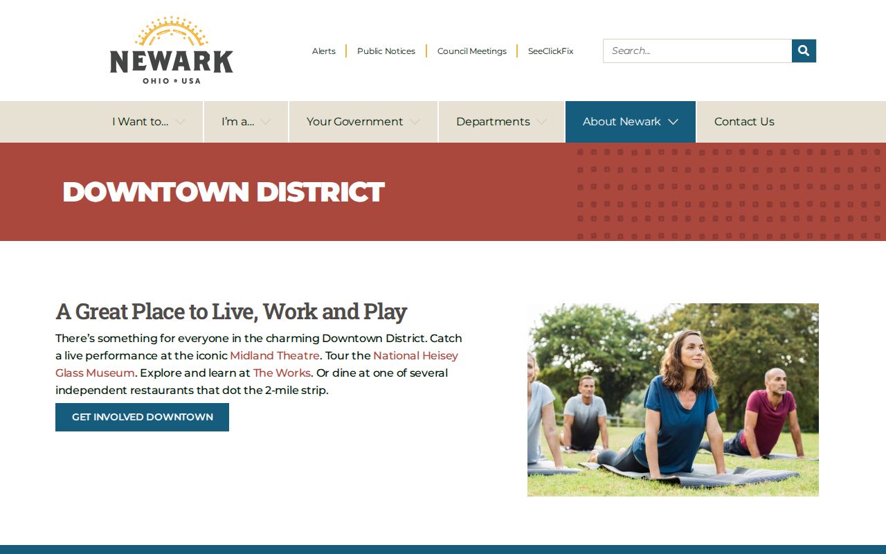
Downtown context can help identify the right local map layer, while a current postal lookup and parcel record answer the address-specific question.
Newark ZIP Record Limits
A postal code, a parcel owner, and a voter record each support different facts. USPS does not confirm a person or company at an address. A tax record identifies property context, and a recorded instrument identifies parties to a transaction. None of those sources turns a ZIP code into a complete list of present residents.
Keep site address, owner mailing address, city, township, jurisdiction, and postal information separate when they appear in the same record. Protected voter records, private utility accounts, motor-vehicle information, and other restricted material remain outside a postal-address search. Use the custodian’s record to correct a factual error and respect confidentiality measures.